News | Mar 29, 2023 | Christyn Binder
Arora HQ Indoors Implementation
Our modern era of rapid innovation has spurred exciting change in the AEC industry. Arora Engineers (Arora) has re-thought the role played by traditional engineering providers and evolved our practice to emphasize the technology that connects systems infrastructure, improves operations and longevity, and makes life safer and easier for those who use it.
At Arora, we encourage staff to explore innovative new ideas, technologies, and solutions for the benefit of our culture and our clients. Life at Arora is a product of both the company’s foundational ingenuity and the passion and expertise of our current leaders. We employ a technology-rich approach to give our clients a holistic view of the lifecycle of their assets, from design, planning and construction to operations and maintenance. We are continuously investing in new services and tools to deliver our clients long-lasting, high-quality solutions that allow them to rethink best practices for infrastructure management.
Arora’s Geospatial Practice is taking full advantage of Arora’s inquisitive and innovative spirit by implementing an Indoor GIS at our Headquarters office in Chadds Ford, PA to test the software, train our staff, and grow the visibility of Indoor GIS and its wide array of solutions – allowing us to bring the power of an Indoor GIS to all of our customers in the build environment.
The Implementation Process
First, we created an ArcGIS Indoor Positioning System (IPS) Information model using the “enable Indoor Positioning” tool in ArcGIS Pro. The IPS model contains the table and feature classes required for surveying facilities and generating a positioning file for use in IPS-enabled apps.
Then, we prepared the map of our Headquarters to be able to leverage the IPS Setup App. The map contains specific layers and stand-alone tables for use in the ArcGIS IPS Setup app. Some of the required layers included building details, units, levels, facilities, and sites. Once the map was created, we shared it out to our internal enterprise environment used for demo and marketing, acquired through our specialty partnership with Esri.
The Fun Part – Surveying!
Once we shared the map, we were able to open it in ESRI’s IPS Set-up App which we used to perform surveys. The survey is a method used to collect radio reference data for an indoor positioning system by creating and surveying paths that pass through every area where you want the IPS to be enabled.
There is not a particular way to create these surveys, so it is more of a ‘science project’ rather than an exact ‘math equation’. These surveys essentially create a positioning file used in ArcGIS Pro – which turns the survey (signal strength of Wi-Fi or Bluetooth (BLE) beacons) into the actual indoor positioning system.
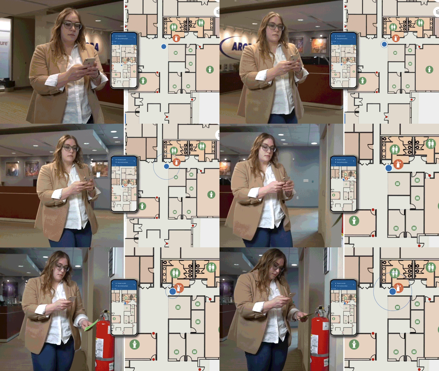
Once we created the positioning file, aka created the IPS, we were able to leverage it in the ArcGIS Indoors apps – specifically ArcGIS Indoors Mobile. But before we went live…testing!
Testing & Enablement
We used test mode in the IPS Set up app to determine whether our indoor positioning accuracy met our expectations. The positioning file, which is stored in the IPS Positioning table, is consumed by the app to display a user’s real-time position on the screen as a blue dot. If there are multiple positioning files in the table, the most recent file is used.
Voila! ArcGIS IPS was enabled!
Key Takeaways from our Team of GIS Experts
Our GIS team provided the following lessons learned for those seeking to implement their own Indoor GIS:
- Enabling an IPS is a science, not an exact math equation. Every environment is different and requires different techniques to enable the blue-dot.
- Hardware is important, but the configuration (UUID, Major, Minors, etc.) of the hardware (in our case, low-energy Bluetooth beacons) is just as, if not more, important.
- Developing a beacon placement plan using defined spatial proximity recommendations will assist with creating an accurate survey.
- We suggest creating long survey paths to increase the positional accuracy of the blue dot.
- Be sure to enable the path snapping within the ArcGIS IPS application.
- Esri has performed surveys using numerous mobile devices to support the IPS survey process and evaluated their positional accuracy and stability, so be sure to check in with Esri to use the best mobile device to support your survey.
Arora’s Geospatial Practice provides a full range of products and services to help our clients leverage geospatial data and technologies to lower the cost and maximize the effectiveness of their planning, design, operations, and maintenance activities. As an approved Esri ArcGIS Indoors Specialty partner, Arora Engineers has the expertise and capacity to quickly transform your indoor floor plans into a digital format that is then used to create configurable map services that fuel web map and mobile solutions that can be distributed via a kiosk, through desktop computers, and/or iOS or Android device. Learn more today!


