BCAD FLL FAR Part 150 Noise Compatibility Planning
Arora Engineers, Inc. (Arora) is currently providing professional Geographic Information Systems (GIS) services to the Broward County Aviation Department (BCAD) for the Part 150 Noise Compatibility project for Fort Lauderdale-Hollywood International Airport (FLL), as a subconsultant. Arora’s role is primarily to provide geospatial data collection, database development, quantitative analysis, and exhibit support.
BCAD is undertaking a 14 CFR Part 150 Noise and Land Use Compatibility Study Update (Part 150 Study) to evaluate opportunities to improve the compatibility of FLL with the surrounding communities taking into consideration the recently completed South parallel runway and the resulting changes in FLL’s operational capability. The project process includes the development of Noise Exposure Maps (NEMs), preparation of a Noise Compatibility Program (NCP), and extensive public involvement. BCAD’s goal is to receive FAA acceptance of the NEMs and NCP that address community concerns while preserving the safety and operational capabilities of the airport, and to conduct a public outreach process that also achieves BCAD’s objective of conducting an open and transparent study process.
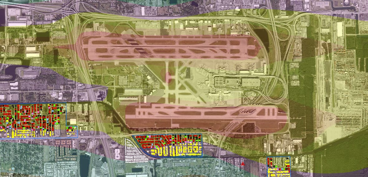
Arora performed geospatial data collection, data analysis, created report exhibits and related data tables to support the Part 150 aircraft noise study for FLL. The study assesses current noise impacts from aircraft operations after the opening of a major new runway in 2014 and evaluates operational alternatives to mitigate noise impacts and foster compatible land uses around the airport. Arora specifically collected land use, zoning, census, and housing population data to support the data analysis which was performed to calculate impacts based on expected changes to noise intervals for specific acreages of land use types, number of dwelling units and residents, and noise sensitive sites such as schools, hospitals, and nursing homes.
Arora leveraged its role as the prime consultant for the Airport’s Enterprise GIS and its integrated noise mitigation application to reconcile dwelling unit counts and affected parcels. Additionally, Arora developed map exhibits and tables for study reports and public meetings. All data collected and analyzed were stored in an organized file geodatabase to carefully track work using comment fields, which was critical for a project with sensitive environmental and public issues and the need for a high degree of analytical precision.
SCOPE OF WORK INCLUDED:
- Using GIS for the development of a comprehensive database of current conditions including base mapping, land use, noise-sensitive sites, and housing/population.
- Analysis and calculation of noise contour impacts, including acreages of specific land use categories, noise sensitive sites, and housing/population.
- Exhibits and graphics illustrating GIS database/mapping and analyses.
- Materials production for community outreach program and public workshops.


