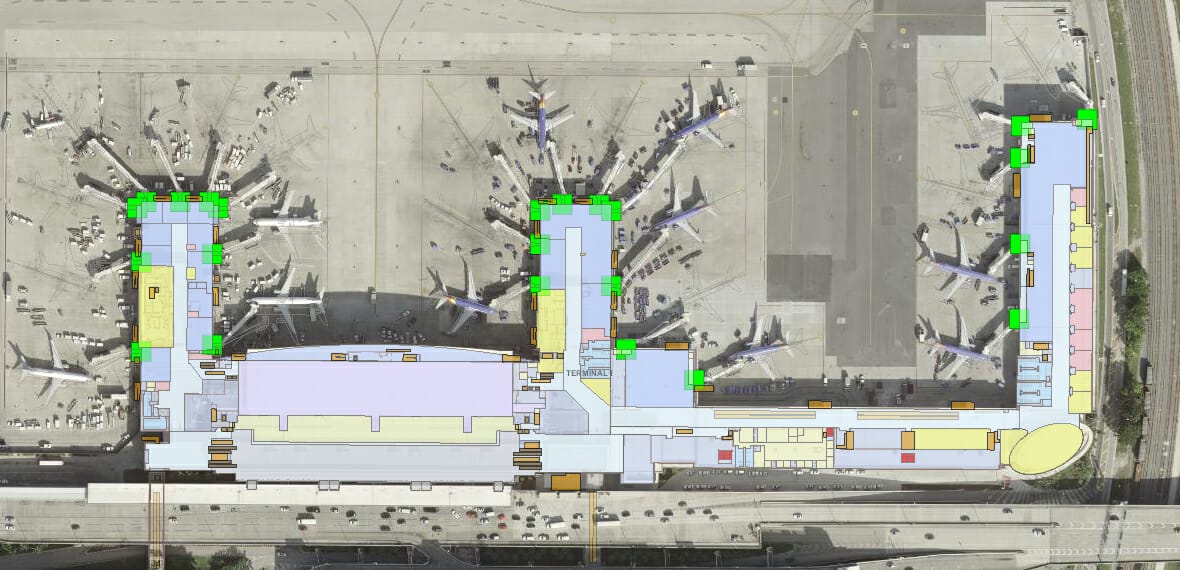
FLL & HWO GIS Program Management & Systems Integration
Arora is currently providing professional GIS solutions and services to the Broward County Aviation Department (BCAD) for the implementation, development, and maintenance of its Enterprise GIS Program at Ft. Lauderdale-Hollywood International Airport (FLL) and North Perry Airport (HWO). Arora is assisting BCAD in the development and implementation of both off-the-shelf and customized applications, leveraging GIS data and technology across multiple BCAD departments and functions. Arora is also leading GIS integration with other systems including Maximo, PROPworks, SharePoint, and BIM. The implementation of these solutions is augmented by Arora’s onsite support and extension-of-staff, Enterprise stakeholder engagement, collaboration and information gathering.
SCOPE OF WORK INCLUDED:
- Enterprise stakeholder engagement, collaboration and information gathering.
- Development & enhancement of geospatial data standards (GIS/CAD/BIM).
- Assessment, development and enhancement of BCAD’s geospatial data workflows, including terminal floor plans, utilities, and airport properties for data governance.
- GIS/CAD Data Acquisition, Conversion, Development, and Maintenance.
- Management of Master Geodatabase, compliant with FAA AGIS standards.
- Design and deployment of technical architecture, including production and development environments of Portal for ArcGIS and applications, plus ArcGIS Online for mobile data collection and viewing using Collector for ArcGIS.
- Development, third-party systems integration, and deployment of Portal applications including:
- Noise Mitigation Program, integration with 3rd-party program tracking databases & SharePoint
- Airport Property Interests, integrated, with SharePoint
- Terminal & Garages Floor Plans, integrated with PROPworks
- Business Leases, integrated with PROPworks
- Amenities including Concessions and Life Safety Assets, with Photos
- Utilities with Record Drawings, integrated with SharePoint
- Airfield Lights and Signs, with planned integration with Maximo
- Assessment, development and enhancement of BCAD’s geospatial data workflows, including for terminal floor plans, utilities, and airport properties for data governance.
- Onsite GIS Support and Extension-of-Staff.


